
 The Pinkerton Forest Time Capsule is to be opened on Wednesday 8 November 2017. Plans to celebrate this event are being made by Melton City Council, Western Water, The Pinkerton Landcare and Environment Group and descendants of the Pinkerton Family.
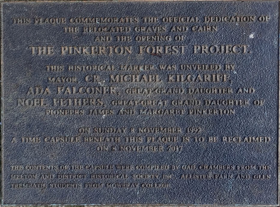
A time capsule was placed under a plaque in Pinkerton Forest,Melton Shire, on 8 November 1992 to mark the culmination of the Surbiton Park and Pinkerton Forest Project.
 Official opening of time capsule
On Wednesday 8th November 2017 the time capsule placed in the memorial cairn in in 1931 and 1992 beside the family graves in Pinkerton Forest was opened in a ceremony attended by many dignitaries, reflecting the importance placed on the environmental, cultural and heritage values of Pinkerton Forest by Melton Council, Western Water and the State Government.
This Pinkerton Forest document was placed in the Time Capsule that was opened on 2017 then re-interred in Pinkerton Forest, in USB form, requiring a detailed summary of our activities over the years in Pinkerton Forest.
Pinkerton Landcare and Environment Group (PLEG) manage this area in partnership with Western Water.
For further information contact the PLEG Secretary.
For approval to visit Pinkerton Forest, please contact Western Water.
|
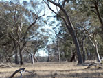
General view of Pinkerton Forest |
The woodland forms a component of the farm, Surbiton Park, used to process waste water by irrigation. When the farm was acquired, eighteen hectares of the 50 hectare woodland was fenced in 1992, to exclude rabbits and control grazing. This action started the restoration process. The history of the forest does not start in 1992, the original inhabitants of the land, the aborigines tended the area for ages prior to the white settlement by the early pioneers, mainly the Pinkerton family.
|
|
|
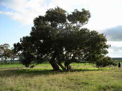
A lone Blue Box, Eucalyptus baueriana ssp thalassina MS. which is specific to the Werribee Catchment |
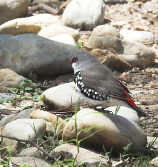
Diamond Firetail |
After six years of restoration work the wildlife has started to return to the woodland, using it as part of the Exford network of grassy grey box woodlands linked to the Werribee River. |

PIONEERS OF THE PLAINS
(Werribee and Keilor)
By Archibald James Campbell * 1853 -1929
Early History
Australia lay in a sunny sleep until the time of her awakening came. In the good Providence of God she is an integral part of the Empire upon which the sun never sets.
Captain Cook sighted the goodly land of Victoria 19th April 1770
The plains of Port Phillip, in part, were probably seen by Matthew Flinders, who on 27th April 1802 ascended and named Station Peak (the You Yangs). From this coign of advantage, towards the distant Mount Macedon northward, he would get an extended panoramic view of the expansive and fertile plains, as yet untrodden by white men.
Early in 1803 Charles Grimes, Surveyor General of New South Wales walked round and surveyed Port Phillip Bay. His report of the country was not very encouraging: - "grassy plains to the mountains, no trees, and the soil very bad and stony."
On the 29th December, the same year, William Buckley (with three other convicts) absconded from the settlement near Sorrento at the Heads. He lived for thirty years with a tribe of blacks and saw much of the Plains. One of Buckley's mates repented and returned to the settlement; the other two perished in the Bush.