
Pinkerton Forest Impressions, Spring 2017 by Joan Bowker


Aboriginal occupants
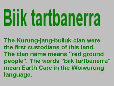
 The two language groups of aboriginal people who shared the Werribee River as their common boundary, were the Woiwurung and Wathaurung. The Woiwurung were composed of several clans including the Kurung-jung-balluk who were located in the area between the Werribee River and Kororoit Creek.
“The clan name means “red ground people” and perhaps refers to the red soil of the basalt country still evident in some areas” (Hilary du Cros and Phillipa Watt, Skeleton Creek Catchment - Aboriginal Heritage Study 1993)
The Aboriginal people who occupied the western side of the Werribee River down to Geelong were of the Mapeang-balluk clan of the Wathaurung language group. There appears to be have been a clear cultural distinction between the inland inhabitants such as the Woiwurung and the coastal people, the Bunerong. Culturally this distinction is expressed in terms of clans or ‘moiety’ which were designated as either ‘bunjil’ (eaglehawk) of ‘waa’ (crow). The ... Kurung-jung-balluk was of the ‘waa’ moiety while the people to the north and those west of the Werribee River were ‘bunjil’. (Barwick 1984)
Corroborees were held close to settlements at Melton and Bacchus Marsh in the 1840 -50’s. Groups of Aborigines were also known to have camped at Cobbledicks Ford (du Cros 1989a.28)
“Aboriginal people relied on a wide range of plant and animal foods, some of which were eaten regularly as staple foods. The types of resources available near the creek and associated swamps would have included fish, water birds, frogs, reptiles and small mammals. The Common Bull Reed, Bull rush and club Rush which provided edible leaves and rhizomes (Gott 1982). The club Reed was an important item. It is reported that in some areas on the plains it grew so abundantly “around marshes and billabongs that it resembled wheat (Gott in O’Neil 1993 11)”. The murnong or yam daisy (Microseris scapigera) was a fructan-rich tuber gathered as a staple food by Aborigine women in the study area (du Cros 1989a, Gott 1993).
 Gum, resin, bark and heart-wood were exploited by aboriginal people for the production of artifacts. Possum skin cloaks were used as a type of warm clothing (Presland 1983, du cros 1988). Stone artifacts were either selected from creek pebbles or quarried from suitable outcrops that occurred outside the study area.” 2.3.1 Exploitation of Resources and Movement Patterns from (Hilary du Cros and Phillipa Watt, Skeleton Creek Catchment - Aboriginal Heritage Study 1993)
Invasion
The Western Region has had a particularly violent contact history. This was worst in the first ‘official’ year of settlement in 1836, although settlers were welcomed by Aboriginal people while they thought their presence was temporary. The impact of grazing by European stock caused a destruction of aboriginal food sources both by the herb and root plants being eaten out and from competition with kangaroo and wallaby. Retaliation by white settlers against Aborigines helping themselves to their sheep was brutal and a cycle of murders continued through the first decades of white settlement. (Cannon 1982 a & b, Barwick 1984, Presland 1983)
“After a space of a few years, many groups were starving and forced to rely on scanty government provisions administered by the Aboriginal Protector for the area or local settlers hand outs.
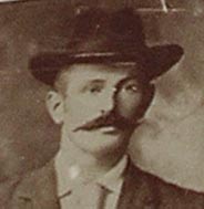
Pinkerton family
"From “ The Argus, Saturday, May 10, 1919
Eventually in 1840 the Pinkertons settled on Kororoit Creek. The plains were then covered with luxuriant herbage and waving purplish-brown kangaroo grass, 4 ft. high, was as thick as a crop of oats. Although the Werribee tribe of blacks was numerous (they came in hundreds at times) they molested no one at this station. Once the brass plate of the sundial was taken. Explanation was made to “King Benbow” that it must be immediately returned; the missing article was soon found. Occasionally Mr. Pinkerton cooked a large boiler of rice for the natives, who were all lined up with each a piece of bark to get a ladle full.”
Other settlers did not treat the aborigines so well.
“However arsenic laced flour and European introduced disease took the heavist toll on the aboriginal population (Popp 1979, Presland 1983) 2.3.2 “Contact History (Hilary du Cros and Phillipa Watt, Skeleton Creek Catchment - Aboriginal Heritage Study 1993)”
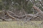
During the 1992 archaeological survey scar trees were found in the Pinkerton woodland, the bark was removed by Aboriginal people for use as containers or shields. Another grey-box tree has footholds cut into the trunk, which may have been used for gathering of honey or as a lookout.
Artifact scatters were located on the edge of the basalt plain above the river escarpment, and another scatter was found on the flood plain.
Notes extracted by Frances Overmars from Surbiton Park Archaeological Survey, Gary Vines 1992
Archeological surveys of the site: du Cros 1989a, 1989b, Presland 1983, Simmons 1980
Pinkerton Landcare and Environment Group (PLEG) manage this area in partnership with Western Water.
For further information contact the PLEG Secretary.
For approval to visit Pinkerton Forest, please contact Western Water.
|
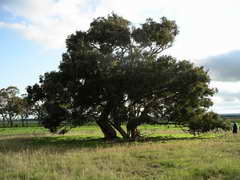
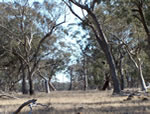
General view of Pinkerton Forest |
The woodland forms a component of the farm, Surbiton Park, used to process waste water by irrigation. When the farm was acquired, eighteen hectares of the 50 hectare woodland was fenced in 1992, to exclude rabbits and control grazing. This action started the restoration process. The history of the forest does not start in 1992, the original inhabitants of the land, the aborigines tended the area for ages prior to the white settlement by the early pioneers, mainly the Pinkerton family.
|
|
|
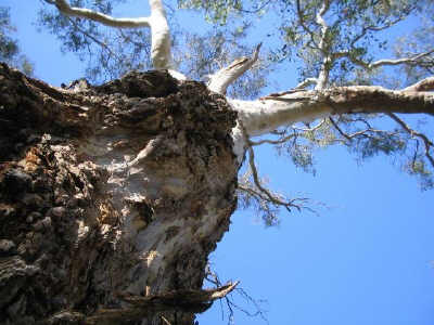
A lone Blue Box, Eucalyptus baueriana ssp thalassina MS. which is specific to the Werribee Catchment |
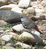
Diamond Firetail |
After six years of restoration work the wildlife has started to return to the woodland, using it as part of the Exford network of grassy grey box woodlands linked to the Werribee River. |

PIONEERS OF THE PLAINS
(Werribee and Keilor)
By Archibald James Campbell * 1853 -1929
Early History
Australia lay in a sunny sleep until the time of her awakening came. In the good Providence of God she is an integral part of the Empire upon which the sun never sets.
Captain Cook sighted the goodly land of Victoria 19th April 1770
The plains of Port Phillip, in part, were probably seen by Matthew Flinders, who on 27th April 1802 ascended and named Station Peak (the You Yangs). From this coign of advantage, towards the distant Mount Macedon northward, he would get an extended panoramic view of the expansive and fertile plains, as yet untrodden by white men.
Early in 1803 Charles Grimes, Surveyor General of New South Wales walked round and surveyed Port Phillip Bay. His report of the country was not very encouraging: - "grassy plains to the mountains, no trees, and the soil very bad and stony."
On the 29th December, the same year, William Buckley (with three other convicts) absconded from the settlement near Sorrento at the Heads. He lived for thirty years with a tribe of blacks and saw much of the Plains. One of Buckley's mates repented and returned to the settlement; the other two perished in the Bush.
| European Heritage, Pinkerton Family | ||
| The area has an important historical significance for Melton and District. | ||
 |
 |
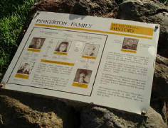 |
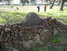
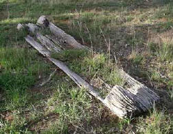
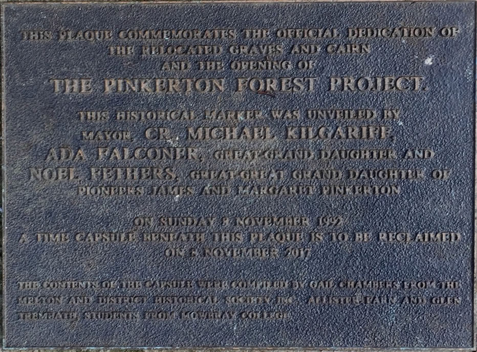
| A Headstone erected by the descendants of the Pinkertons on the grave of Margaret, wife of James Pinkerton, and 4 grandchildren. | A wooden feeding trough, still survives | A Plaque describing the Pinkerton Family history. |
|
Historical Note: James and Margaret Pinkerton & Family left Glasgow, Scotland on 8 July 1839 - sailing from Greenock on the Barque "Superb". They arrived at Port Phillip on 4 December 1839. In 1840 they settled in the Keilor District on a property called "Chamois Ponds". In 1848 the property was burnt-out and the family moved to the Werribee River, settling on the new property "Yaloke". In 1855 Margaret Pinkerton died & was buried in Pinkerton Forest. Between 1857 & 1860 4 grandchildren died (aged 9,8,1 & 2 years) and were also buried in the forest. A cairn was erected over the graves in 1931. After adverse times W J Clarke ("Big Clarke") acquired the property in 1862 and James Pinkerton retired to Bacchus Marsh where he died in 1869. |
||
|
Descendants of Note: |
||

Archibald James Campbell -Expertise in Australian Birds & Native flowers, particularly Wattles. A J Campbell was one of the founders of Wattle Day, and he planted wattles around the original cairn in the forest. |
Yellow Wattle the weeping wattle for grief. The happy may rejoice |
|
James Pinkerton Campbell Founder of Film Australia & Official Australian War Photographer in Egypt in WW1. |
||
|
Descendants photo, taken at the 'Celebration of the new extension of Pinkerton Forest on Friday 6 October 2006. Names are L to R - Noel Fethers, Bryan Campbell, Don Nardella MP, Dorothy Campbell (wife of John) and John Campbell' |
 |
|
This Pinkerton Forest document was placed in the Time Capsule that was opened on 2017 then re-interred in Pinkerton Forest, in USB form, requiring a detailed summary of our activities over the years in Pinkerton Forest.
 Official opening of time capsule
On Wednesday 8th November 2017 the time capsule placed in the memorial cairn in in 1931 and 1992 beside the family graves in Pinkerton Forest was opened in a ceremony attended by many dignitaries, reflecting the importance placed on the environmental, cultural and heritage values of Pinkerton Forest by Melton Council, Western Water and the State Government.
 The Pinkerton Forest Time Capsule is to be opened on Wednesday 8 November 2017. Plans to celebrate this event are being made by Melton City Council, Western Water, The Pinkerton Landcare and Environment Group and descendants of the Pinkerton Family.
A time capsule was placed under a plaque in Pinkerton Forest,Melton Shire, on 8 November 1992 to mark the culmination of the Surbiton Park and Pinkerton Forest Project.
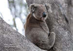 Koalas can still be seen in the woodland remnants around Melton.
Koalas appear to have made a tentative return to Pinkerton Forest. Quarterly bird surveys by Birdlife Australia and Pinkerton Landcare & Environment group have observed Koalas on three occasions in the twelve months.
|
|
| Bearded Dragon Pinkerton 3 Nov 2014 |
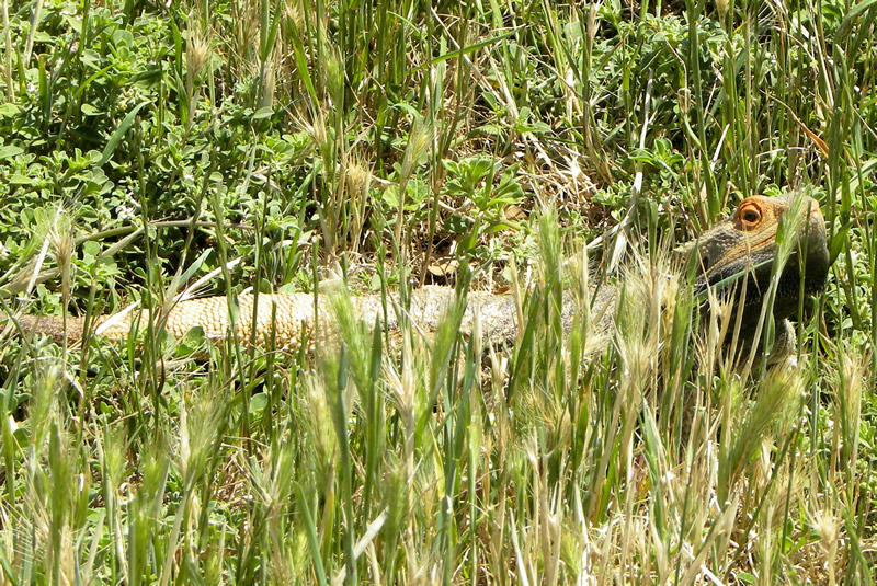
This large Bearded Dragon (Pogona barbata) was recently found in farmland adjacent to Pinkerton Forest. About 40 cm in length it was sunning itself on a gravel track, before running off into a Melicytus bush growing over a rabbit warren, beside the track. Two smaller relatives are found locally; Jacky Lizards in Eynesbury & Mountain Dragons in the Pyrete Forest. The Bearded Dragon is much larger & more robust than the smaller local dragons, with more pronounced head spines (& expandable beard). These fearsome looking lizards are both inoffensive & harmless!
This sighting would appear to be outside their usual range as according to DEPI ‘Bearded Dragons are generally found in the warmer parts of Victoria, north of Melbourne’. ‘The preferred habitat of Bearded Dragons are trees in woodlands and dry sclerophyll (Eucalyptus) forests where they can observe their territory, catch prey, bask in the sun and sleep.’
|
|
| Jacky Lizard Eynesbury 30 Aug 2011 |

Its appearance here is something of a mystery. The habitat would suit them as Pinkerton Forest is dry sclerophyll woodland (Grey Box Grassy Woodland). Perhaps it may be an escapee? Nora Peters also photographed a Bearded Dragon a year or so ago between Melton & Toolern Vale, so perhaps their range may extend further south than maps allow.

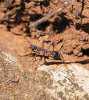
This is the large bull ant that roams the Pinkerton forest. It's called a Myrmecia nigriceps among other things, especially if its not biting. (click to enlarge)
The ant is noctidiurnal, prefers open forest & woodland, is a predator and nests in soil.
 |
Ants at Pinkerton Forest: |
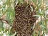 |
Bees |
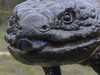 |
Blue Tongue Lizard |